Tropic of Cancer Marker
Updated:2024-11-20
Popularity
91093Feature
- Nature and ecologyNature and ecologySouth of the Tropic of Cancer marker is the tropical climate zone while and the north of it is the subtropical climate zone. Due to the high humidity and abundant rainfall, this area has dense forests and is rich in flora and fauna.
- Odd rocks of DafengfengOdd rocks of DafengfengThe two odd Dafengfeng rocks are located at the junction of Hualien and Taitung, adjacent to the Tropic of Cancer landmark. It is easy to get there.
From the 73-km marker on Provincial Highway 11, walk to the beach in front of the Pakelang Boathouse, where you can see a pleated skirt-like, tower-shaped andesite. Walk up along the hexagonal joints. The top of the rock looking like a crater is a volcanic neck formed by lava passing through. The other rock is columnar andesite, with rectangular and hexagonal rocks lined up and many kinds of ferns growing on it.
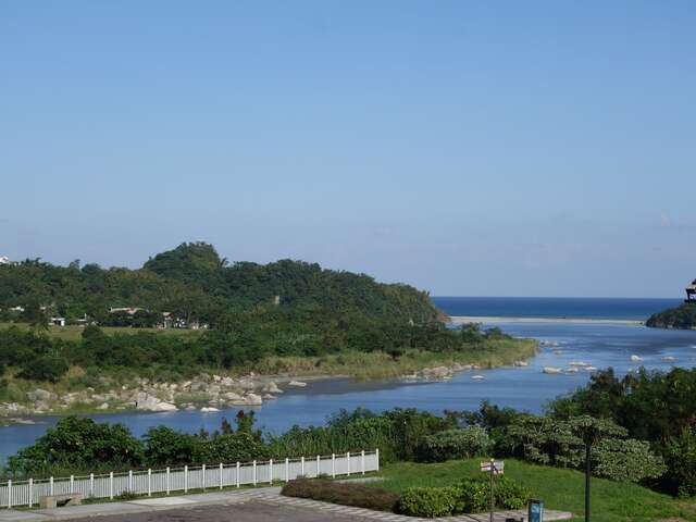
This is a rare wild lily habitat on the East Coast. When walking in this area, please pay attention to the wild lily seedlings that look like weeds. - The hometown of hairy crabs—Balaeluan CreekThe hometown of hairy crabs—Balaeluan CreekBalaeluan Creek means "division" in the Amis language. As the estuary is next to the Tropic of Cancer marker, the creek happens to be the dividing line between tropical and subtropical zones.
Balaeluan Creek has not been reclaimed and developed, so it could retain its most pristine and natural features and its extremely rich ecological resources, such as muntjacs, Taiwan moles, red-bellied tree squirrels, LaTouche's frogs, common Chinese tree frogs, stag beetles.
The estuary of the creek is directly connected to the sea and therefore is a special environment where seawater and freshwater blend. It is particularly suitable for migratory fish, shrimps, and crabs to thrive. As a result, many precious aquatic species, such as hairy crabs, pea crabs, mitten crabs, freshwater shrimps, giant mottled eels, monk gobies, and flagtails. It is an excellent place to observe migratory fish, shrimps, and crabs here. In summer and autumn, tens of thousands of young mitten crabs finding their way back home to their previous generation is a magnificent and breathtaking view.
In order to protect the environment of Sanfu Creek, Jingpu villagers established the Balaeluan Creek Protection Association in 1999. Almost all residents participated in the protection work so that the ecological resources of Sanfu Creek were kept intact. If you would like to visit this creek, it is recommended that you contact the Protection Association in advance. Balaeluan Creek Protection Association, Jingpu Village, Fengbin Township, Hualien County: 03-8781274 - Accessible facilitiesAccessible facilitiesAccessible facilities are available here. Please refer to the map.
Details
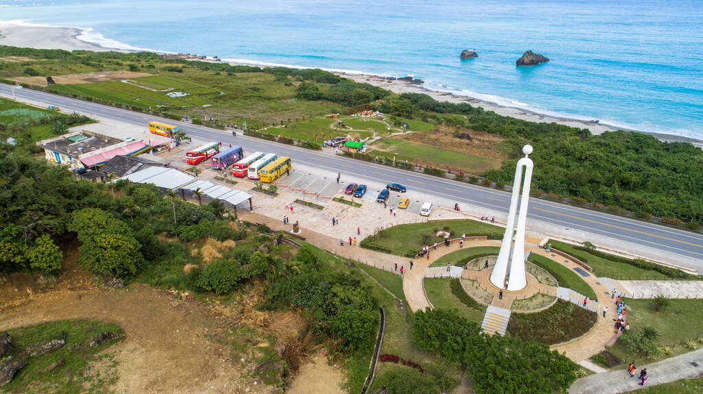
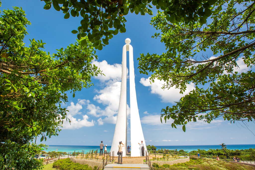
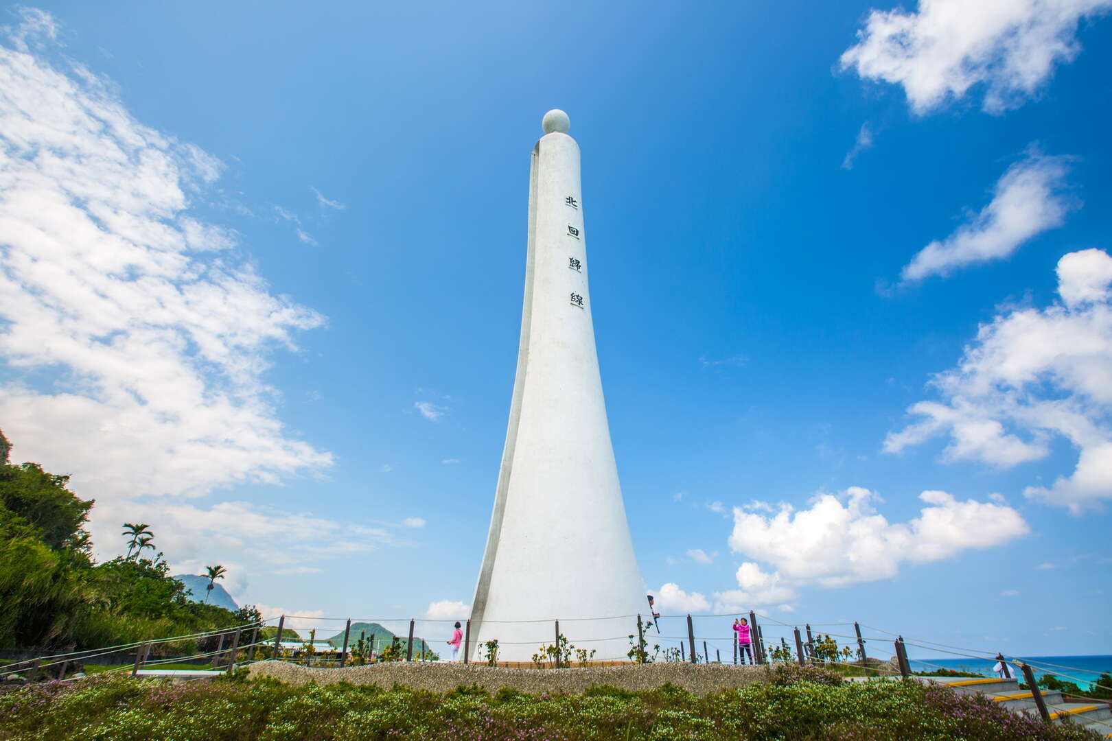
There are three Tropic of Cancer markers in Taiwan, located in Shuishang in Chiayi, Wuhe Terrace in Hualien, and Fengbin Township. This Tropic of Cancer marker is located at the 70.5-km marker of Provincial Highway 11. The white landmark sits within the beautiful scenery of the Coastal Range and the Pacific Ocean, attracting tourists to make a stop here and take pictures. Do you know why there is a thin slit in the center of the Tropic of Cancer marker?

The Tropic of Cancer refers to 23.5°N latitude, which is the dividing line between tropical and temperate zones. The most obvious manifestation is that tropical fruits such as pineapples and custard apples mainly grow south of the Tropic of Cancer in Taiwan, while the main crops in the north are temperate crops such as tea and rice. At noon in the summer solstice, sunlight will shoot right into the slit of the Tropic of Cancer. In this very moment, visitors next to the tower can have the amazing experience of having no shadows under the sun! So, in addition to taking pictures here as a souvenir, read the signs with information to know more about the mystery of seasons!


The Tropic of Cancer refers to 23.5°N latitude, which is the dividing line between tropical and temperate zones. The most obvious manifestation is that tropical fruits such as pineapples and custard apples mainly grow south of the Tropic of Cancer in Taiwan, while the main crops in the north are temperate crops such as tea and rice. At noon in the summer solstice, sunlight will shoot right into the slit of the Tropic of Cancer. In this very moment, visitors next to the tower can have the amazing experience of having no shadows under the sun! So, in addition to taking pictures here as a souvenir, read the signs with information to know more about the mystery of seasons!

Information
Open Time
/Always open.
Facilities
- Parking lot
- Toilets
How to Get There
Choose a transportation method based on your departure location. Remind
1.The Tropic of Cancer at 23.5 degrees north latitude is the northen border of earth of the direct sunlight; In other words, on the summer solstice, the sun rises in the east and goes down in the west following the latitude. To coordinate this phenomenon, the tower is designed with a slit in the midle of the structure, so that visitors can observe this phenomenon.


