Topography
Breathtaking Landscapes A Natural Geography Classroom
The East Coast region follows the convergence of the Philippine and Eurasian tectonic plates. The land was formed by the movement of the plates along with sea erosion and rivers that flow down steep hills and through deep valleys and terraces. The East Coast consists of a great variety of coral reefs, and erosion has, over time, created an ever-moving landscape.
The coastal range, which was formed by volcanic rock, is the northern extension of Luzon Island. The range was created through the solidification of andesite magma, sedimentary stone from the ocean bed, and igneous rock from the Central Mountain Range.
Geographically unique and stunning in its beauty, the coastal range spans from Hualien to the Beinan River. It includes coastal terraces, sandy beaches, gravel beaches, reefs, offshore islands, capes, and marine-erosion land formations such as marine benches, caves, and ditches. As the tectonic plates continue to move together, the land will continue to rise, resulting in a natural geology classroom.
The Evolution of the Island Arc from the Coastal Range
Four million years ago, the Philippine Sea plate and Eurasian plate collided, forming the Penglai orogeny. This marked the emergence of Taiwan Island from beneath the Pacific Ocean.
The Coastal Range, situated between Hualien and Taitung, extends north and south like two sharp shuttles. The rock composition within the range includes Qimei igneous complex rock, the Crest Hill layer, the Da Gangkou layer, the Liji Hill layer, and Puyuma conglomerate.
The combination of coastal mountain rocks and these layers has documented the evolution of the island arc. This process encompasses volcanic regions, rapid sediment accumulation decline, and sediment generated by plate collision.
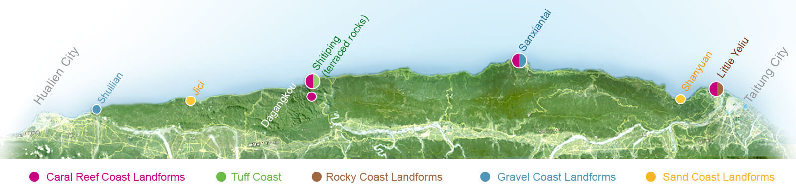
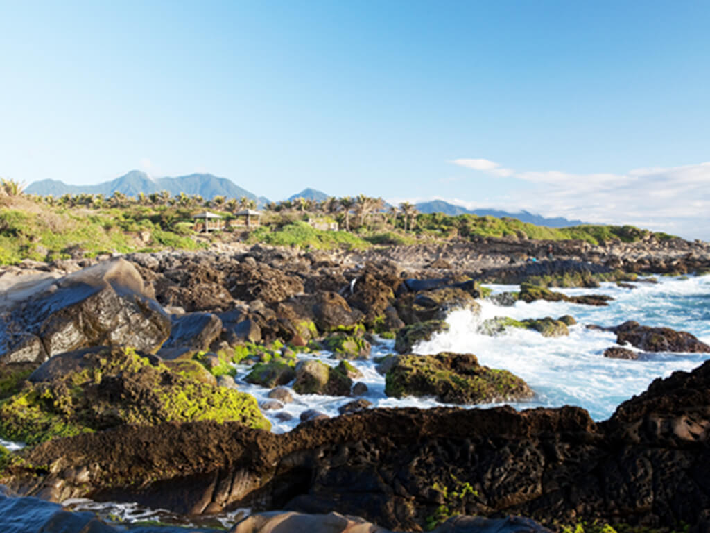
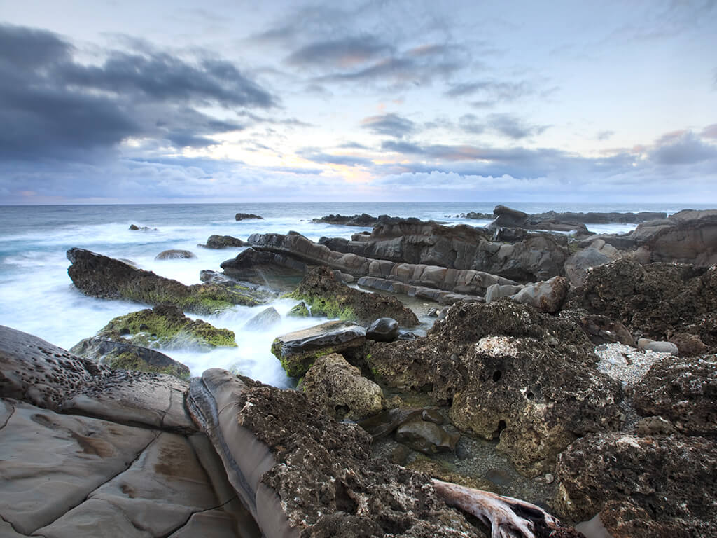
Coral Reef Coast Landforms
In some areas along the East Coast, such as Little Yeliu, Sanxiantai, Da Gangkou, and Shitiping, it is possible to observe the uplifting of coral reefs. Coral reefs are formed by the accumulation of underwater coral remains. On the east coast, these reefs are scattered around volcanic rocks, and as the land rises, they are gradually being exposed along the coast..
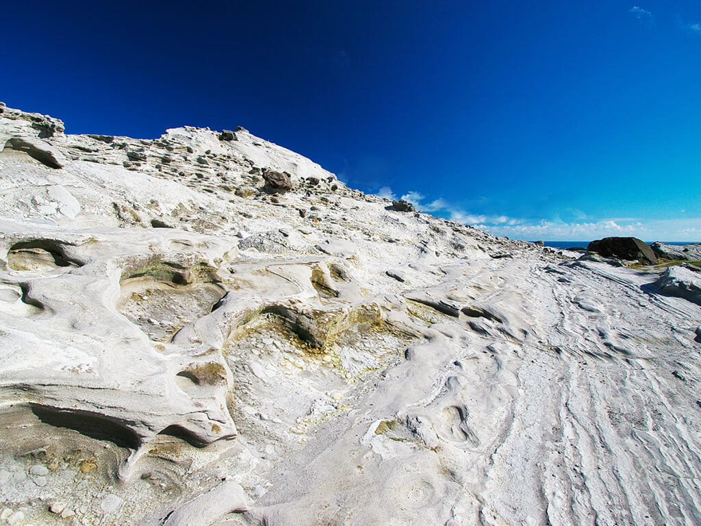
Tuff Coast
Approximately 400 million years ago, intense volcanic activity occurred on the East Coast. During this volcanic activity, coarse and fine rock fragments, as well as volcanic ash, were ejected into the air. These materials settled on both land and sea, forming pyroclastic rocks. The finer particles of volcanic ash deposits created tuff. The white area along the Shitiping Coast represents the tuff coast, where you can still observe volcanic ash deposits and the role of water among the layers.
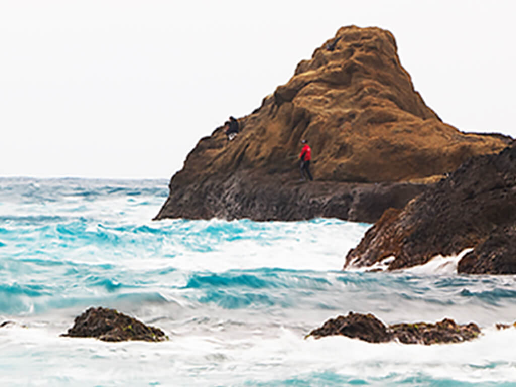
Rocky Coast Landforms
The rocks in the eastern coastal range primarily consist of gravel, sand shale, and andesite volcanic rock. Some areas are composed of hard rock, resulting in high peaks and steep sea cliffs. Over time, wave action has impacted these sea cliffs, leading to the formation of concave sea walls that continue to evolve. Gradually, wave-cut platforms and rocky terrain have developed.
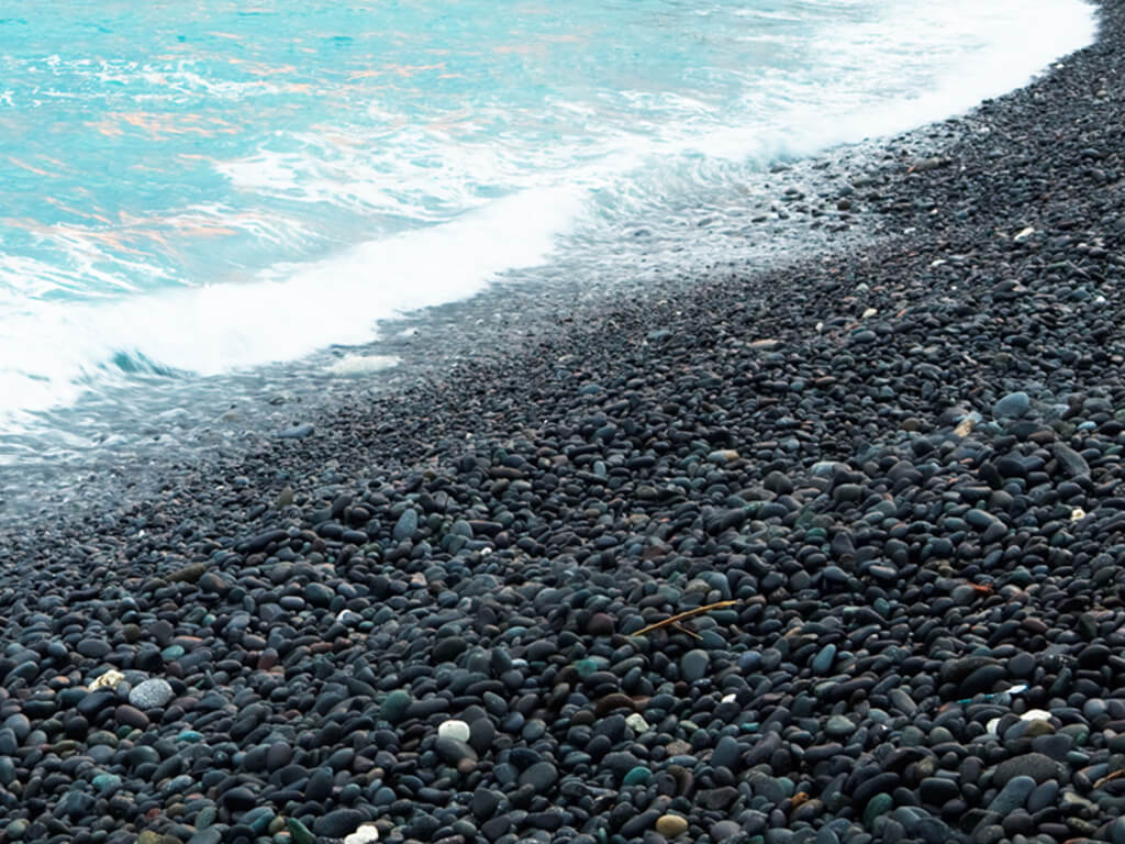
Gravel Coast Landforms
By examining the size of sand sediments, one can determine the type of beach. For instance, if the sediment exceeds two millimeters in diameter, it is classified as a gravel beach or gravel shore, as seen at Sanxiantai. Gravel beaches mainly consist of porphyritic andesite pebbles, with a smaller portion composed of limestone gravel. Powerful waves often contribute to the development of gravel beaches.
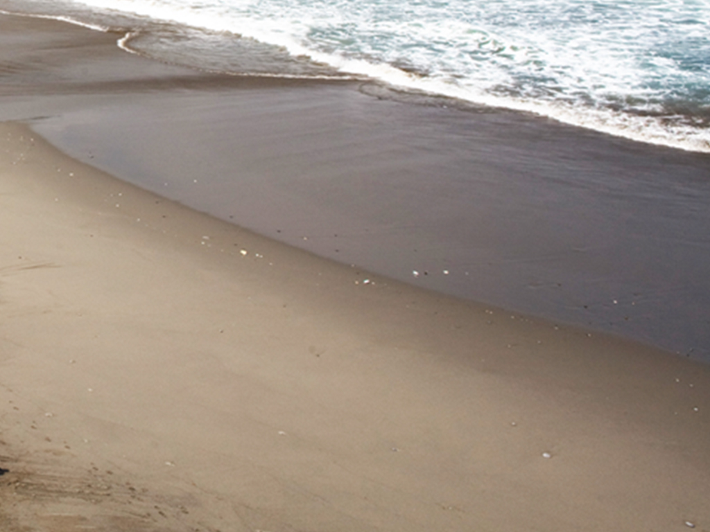
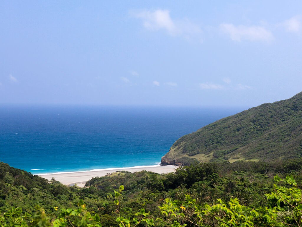
Sand Coast Landforms
Beaches are formed by the accumulation of sand carried by waves and coastal streams. If the beach sediment is loose and soft, it is known as a sandy beach or sandy shore. Jiqi on the east coast exemplifies a typical sandy shore. Due to differential erosion, Bali Bay—with its soft rock—has formed a recessed bay that effectively gathers sand. Bali Bay's beach is sandy and gray, extending behind a wide coastal terrace.
Climate
Across the Tropic of Cancer Rainfall and sunshine
Taiwan spans approximately 250 kilometers in length. The Tropic of Cancer, which delineates the boundary between the tropics and subtropics, intersects Taiwan between Hualien and Taitung counties. Consequently, the climate in these two counties is remarkably similar. Traditionally, temperatures in Hualien are 1-2 degrees Celsius lower than in Taitung. During winter, temperatures range from 16 to 20 degrees Celsius. In summer, the average temperature varies from 17 to 29 degrees Celsius, occasionally exceeding 30 degrees Celsius. The surrounding mountains and sea provide natural protection against the heat from western Taiwan.
Monsoon
Summer in Taiwan lasts from May through July. During this time, the southwest wind prevails. From October to the following March, Taiwan experiences winter, characterized by the cold northeast wind originating from northern China. The winter wind blows in the same direction as the northeast trade winds, making it stronger than the summer monsoon.
Typhoons
The East Coast of Taiwan frequently encounters typhoons, particularly between August and October each year. These typhoons form in the western Pacific Ocean during summer and often pass over Taiwan. There is a significant likelihood that they will make landfall along the East Coast, causing floods, landslides, and other disasters. Even if a typhoon only grazes Taiwan, it can still generate huge waves that crash onto the shores, creating spectacular scenes.
Rainfall
The East Coast receives heavy rainfall, with an annual average of up to 2000 mm. However, most of the rain occurs during the torrents associated with summer typhoons. There are relatively few continuous rainy days, and the weather is often sunny and suitable for travel, especially in Taitung.